The previous article on deer seeker (Shika Seeker) is (→here).
Despite the title, there are no deer in this article.
I recently wrote an article about
Nabeyatoge Pass with its freshly resurfaced asphalt (→here),
and I'll write some supplementary notes about that first.
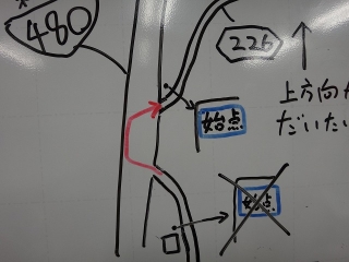
In the previous article, I wrote that the new Route 480 cuts straight through
the old Route 480, which is also Prefectural Road 226.
About this, as shown in the diagram, initially
I was taking a route that crossed the new Route 480 twice,
but the new Route 480 is an expressway limited to automobiles, and bicycles
cannot travel through the tunnel below it or the bypass tunnel further ahead.
So this route that crosses the new Route 480
might be problematic under traffic law,
and a regular customer pointed this out to me today,
but I actually thought so too, and I climbed Nabeyatoge Pass again
early this morning for research purposes.
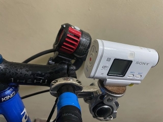
This is an image after arriving home, with a Sony action camera and
a VOLT 6000 (handlebar light) mounted on the handlebar.
Am I the only one who gets flustered by the term "action camera"?
It reminds me of Scola and Della Beppin.
Today the probability of precipitation was 20% until 6 AM,
and 100% after 6 AM, but I didn't make it to the summit of Nabeyatoge Pass.
Around 4:30 AM on the way up, light rain started to fall
and hit my face, so I got scared and decided to descend,
but after that there was no sign of rain,
and I thought "I could've made it to the summit!"
Then when I was just 2 km from home, it suddenly started raining hard,
and I got caught in a brief shower.
If I had gone to the summit, I would've had to
ride through about 20 minutes of steady rain.
Below are still images from video shot with the action camera
mixed with images from my smartphone camera.
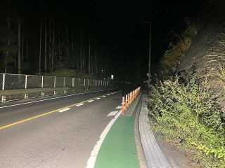
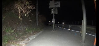
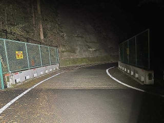
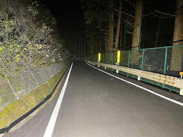
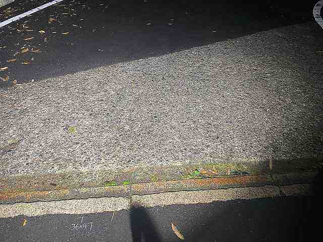
↑This is where it merges with the new Route 480.
About 30 meters before this, there was a sign saying
bicycles should walk through the bypass section (new Route 480).
This doesn't mean to carry your bike across the new Route 480,
but rather to walk on the green area shown in the image.
True, that way you won't have an accident dealing with automobiles on the road.
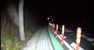
However, this sidewalk-like path is not asphalt paved
but has a continuous cover of fine-mesh grating,
and there are sections so narrow that bicycles can barely pass each other.
Also, it's quite a long walk, so walking is not realistic,
and in practice you'd probably ride the whole way,
but the sign is probably there just as a gesture to show
"we did at least put up a warning to walk".
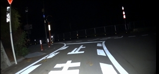
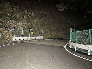
This is a still from video of riding on the sidewalk on the way back,
from the upper merge point to the lower merge point.
From here I turned left and entered the sidewalk,
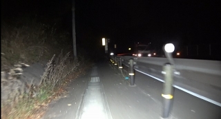
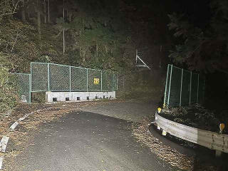
This far is asphalt,
but beyond this the road surface gets narrower.
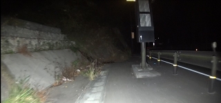
Where there are posts instead of guardrails,
you have no choice but to ride over metal covers.
If they're wet (or frozen in winter),
there's a risk of slipping and it's dangerous.
...Yeah, better to walk after all! ←official line
I've reached the lower merge point.

Going back in the timeline, this is at the sign of the sawmill
on the old road before the merge point, which was once
one of the starting points for timing passes at the summit.
On the utility pole in the image that has a street light,
there used to be a weather-related blue sign.
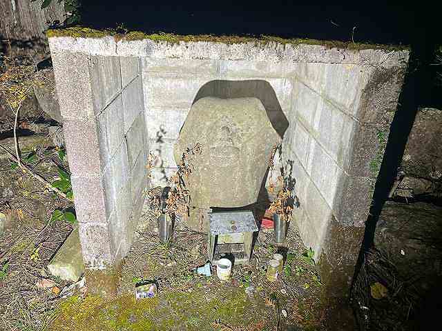
This is the Jizo (statue) curve.
If starting from the sawmill, the time to here is
roughly 1/3 of the time to the finish.
This is pretty consistent whether you're slow or fast.
The stainless steel flower vases on both sides of this Jizo statue
were made by Nabeyatoge Pass Legend (Nabeyatoge-suto) (→here).
In the image they're a bit withered,
but flowers at this Jizo have regularly been changed by someone.
This mountain road has no shops or houses along the way,
not even vending machines, and if you were walking to get here,
it would be quite a journey,
but the fact that someone regularly makes the effort to come all the way here
just to care for the Jizo, not as an afterthought but on purpose,
tells you something about this place.
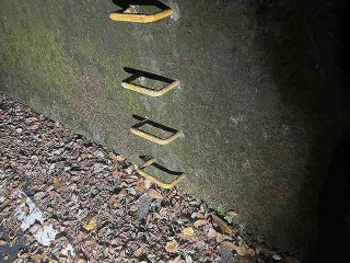
This is the location I wrote about in the previous article, where
there's a staple-shaped yellow ladder on the right slope.
By time, you should be around 2/3 of the way here.
There's another identical ladder a bit further ahead,
but the intermediate lap is taken at the one before this.
Just before this ladder, the gradient becomes noticeably less steep,
and there's a visible seam in the asphalt color,
and that's where the lap was taken when passing through,
but the asphalt seam that was used as a marker
has disappeared due to repairs.
Since starting from the sawmill is no longer done anyway,
it might not be useful as a timing reference.
But knowing that the gradient becomes easier after this ladder is useful information.
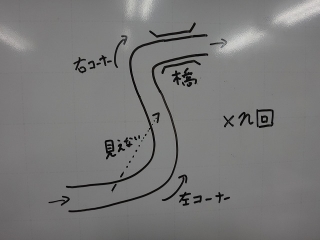
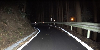
About the blind left corner on the descent in
the diagram from the previous article:
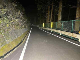

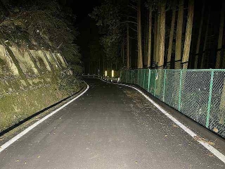
↑These are all different locations, but
they have in common a sharp left corner
after a straightaway.
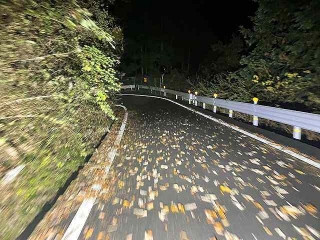
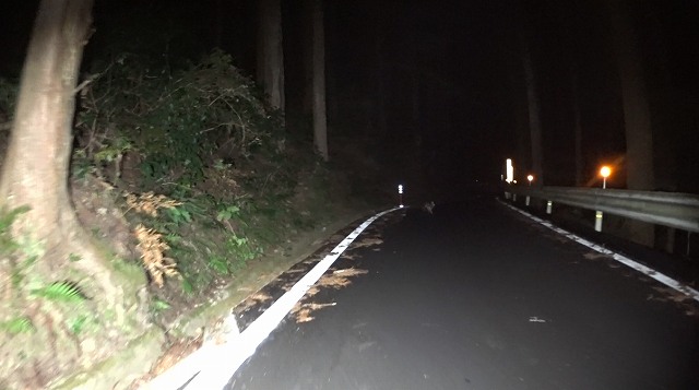
Higher up there were lots of fallen leaves.
If they're wet, they can be surprisingly slippery, so be careful.
These look like the same image repeated,
but actually they're all different bridges.
Concrete paving on the bridge with right corners alternates
with the left corners I mentioned earlier, continuing over and over.
Since I turned back around where the yellow ladder is when light rain started,
the images are only from below that point, but
there are similar features above as well.
Before the repairs, there were tricky steps at the boundaries
between these bridge surfaces and the surrounding pavement,
but they've been neatly filled in on almost all bridges.

This concrete section fairly far down is
the only bridge with an angled cut like a slice of hanpen (fish cake),

and it has a somewhat larger seam, so be careful.
Next, about the deer seeker element in this article.
I used the action camera because the last time I climbed Nabeyatoge Pass,
I encountered a raccoon.
Not a tanuki (racoon dog). The tail had complete stripes.
Two of them were on the right side of the road when I suddenly appeared,
they got scared, zipped across in front of me, and escaped into the grass on the left,
and I spotted another individual separately.
I wanted to film that, so I mounted the action camera
on the handlebar, but I didn't encounter any raccoons.
However...

I encountered a Mountain hare on the descent!
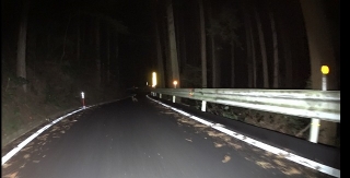
Super quick!
↑This guy
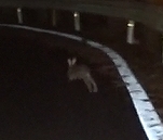
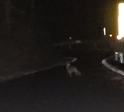
↑This frame looks most rabbit-like.
After this, it ducked under the guardrail on the right
and escaped into the forest...
On the same Izumi mountain range as Nabeyatoge,
there's a pass called Inunaki-yama (dog-bark mountain).
The hot spring there is read as Inunaki "yama".
There's also a hot spring called Jimpu (Jimpu-onsen) along the road,
so it's sometimes called Jimpu Pass.
The tunnel at the summit is also called Inunaki Tunnel,
but its official name is Ikeda Tunnel.
Previously, on a climb there, I saw quite a large raccoon,
two of them in the center line of the road,
and on the descent I saw a mountain hare on the left white line,
so later I went twice with an action camera mounted,
but both times came up empty.
However, I did go to the summit tunnel and take photos.
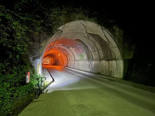
↑Ikeda Tunnel, Wakayama side
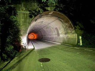
↑Ikeda Tunnel, Osaka side
It has a spooky vibe.
These weren't taken on the same day—
the second one is 5 days after the first.
Also, though I wrote Osaka side on the second one,
the truth is this tunnel is not at the prefectural border;
the border is about 2 km before the tunnel,
and even the Jimpu hot spring beyond that
is located in Kino-kawa, Wakayama Prefecture.
The descent on the Osaka side there is useful for checking
whether my homemade chain guide (→here) is working
(whether chain drop is occurring), so
that was originally my motivation for the climb,
and seeing the raccoon and hare motivated my two subsequent visits.
This was in August, when during the COVID situation
there was stronger social pressure against traveling to other prefectures,
so I didn't descend to the Wakayama side.
This is another matter, also on the Izumi mountain range, the
newer tunnel of the newly switched road at Kazahaki Pass.
This was in June, the time was around 6:40 AM,
but at this time of year now, sunrise is around then so it wouldn't be this bright.
Before this tunnel there were (at least back then)
multiple signs like "Please avoid non-essential outings!"
and the pressure to not come to Wakayama for no good reason was so strong
that even though I didn't have a real purpose, I turned right around
and went back the way I came.
Actually, the prefectural border here is just a bit before the rest area,
so technically I did cross into Wakayama Prefecture.
At this time I had a Fizik Adaptive saddle mounted,
and I'll write an article about that eventually.
↑In front of the rest area toilet I just mentioned
The time I came before, there was
a swallow nest with chicks in the building housing the toilet,
but since it was near the entrance of the women's restroom,
I was afraid of being misunderstood, so I didn't take a photo.

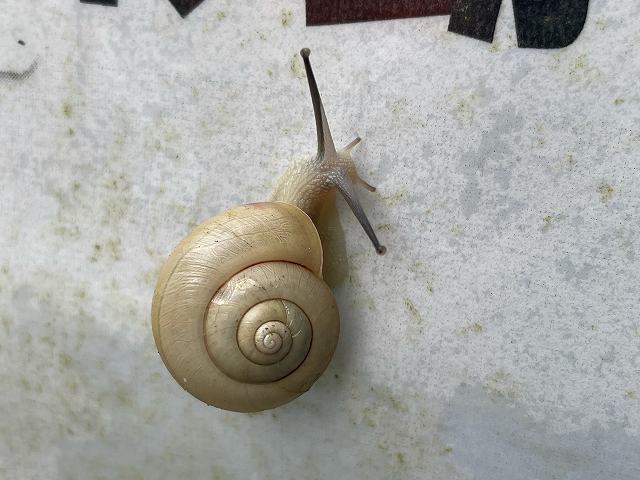
↑Snail Sensei
When I dripped some water from my bottle on it, it seemed to perk right up.
Despite the title, there are no deer in this article.
I recently wrote an article about
Nabeyatoge Pass with its freshly resurfaced asphalt (→here),
and I'll write some supplementary notes about that first.

In the previous article, I wrote that the new Route 480 cuts straight through
the old Route 480, which is also Prefectural Road 226.
About this, as shown in the diagram, initially
I was taking a route that crossed the new Route 480 twice,
but the new Route 480 is an expressway limited to automobiles, and bicycles
cannot travel through the tunnel below it or the bypass tunnel further ahead.
So this route that crosses the new Route 480
might be problematic under traffic law,
and a regular customer pointed this out to me today,
but I actually thought so too, and I climbed Nabeyatoge Pass again
early this morning for research purposes.

This is an image after arriving home, with a Sony action camera and
a VOLT 6000 (handlebar light) mounted on the handlebar.
It reminds me of Scola and Della Beppin.
Today the probability of precipitation was 20% until 6 AM,
and 100% after 6 AM, but I didn't make it to the summit of Nabeyatoge Pass.
Around 4:30 AM on the way up, light rain started to fall
and hit my face, so I got scared and decided to descend,
but after that there was no sign of rain,
and I thought "I could've made it to the summit!"
Then when I was just 2 km from home, it suddenly started raining hard,
and I got caught in a brief shower.
If I had gone to the summit, I would've had to
ride through about 20 minutes of steady rain.
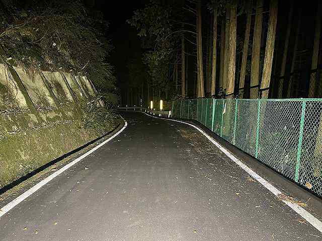
Below are still images from video shot with the action camera
mixed with images from my smartphone camera.

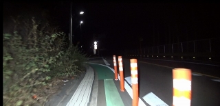
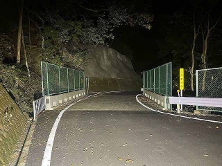
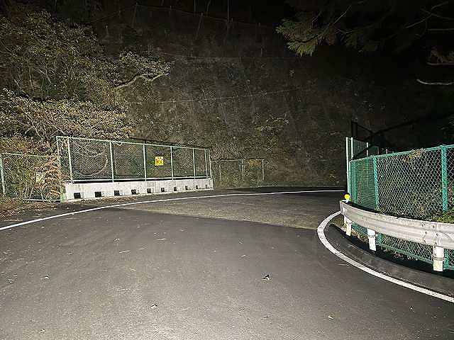
↑This is where it merges with the new Route 480.
About 30 meters before this, there was a sign saying
bicycles should walk through the bypass section (new Route 480).
This doesn't mean to carry your bike across the new Route 480,
but rather to walk on the green area shown in the image.
True, that way you won't have an accident dealing with automobiles on the road.
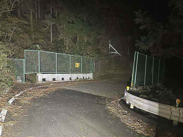
However, this sidewalk-like path is not asphalt paved
but has a continuous cover of fine-mesh grating,
and there are sections so narrow that bicycles can barely pass each other.
Also, it's quite a long walk, so walking is not realistic,
and in practice you'd probably ride the whole way,
but the sign is probably there just as a gesture to show
"we did at least put up a warning to walk".

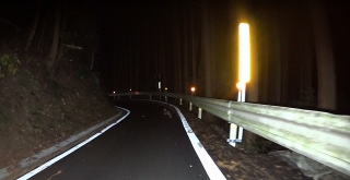
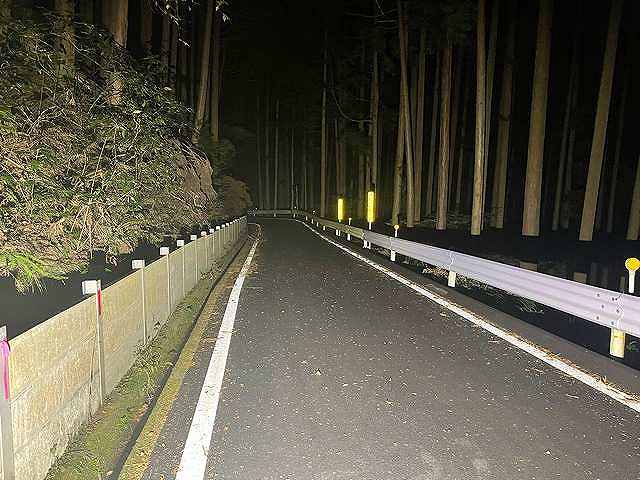
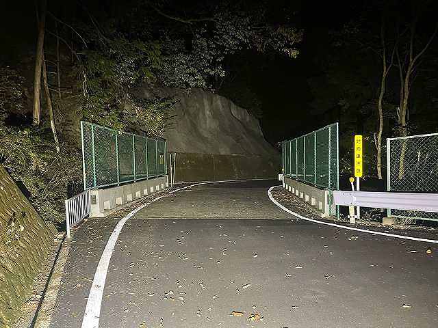
This is a still from video of riding on the sidewalk on the way back,
from the upper merge point to the lower merge point.
From here I turned left and entered the sidewalk,


This far is asphalt,
but beyond this the road surface gets narrower.

Where there are posts instead of guardrails,
you have no choice but to ride over metal covers.
If they're wet (or frozen in winter),
there's a risk of slipping and it's dangerous.
...Yeah, better to walk after all! ←official line

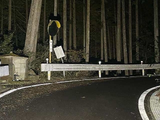
I've reached the lower merge point.
Going back in the timeline, this is at the sign of the sawmill
on the old road before the merge point, which was once
one of the starting points for timing passes at the summit.
On the utility pole in the image that has a street light,
there used to be a weather-related blue sign.

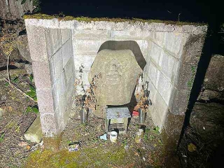
This is the Jizo (statue) curve.
If starting from the sawmill, the time to here is
roughly 1/3 of the time to the finish.
This is pretty consistent whether you're slow or fast.
The stainless steel flower vases on both sides of this Jizo statue
were made by Nabeyatoge Pass Legend (Nabeyatoge-suto) (→here).
In the image they're a bit withered,
but flowers at this Jizo have regularly been changed by someone.
This mountain road has no shops or houses along the way,
not even vending machines, and if you were walking to get here,
it would be quite a journey,
but the fact that someone regularly makes the effort to come all the way here
just to care for the Jizo, not as an afterthought but on purpose,
tells you something about this place.
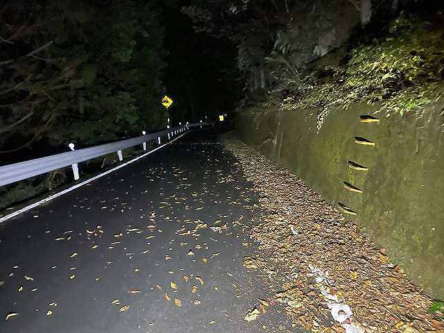
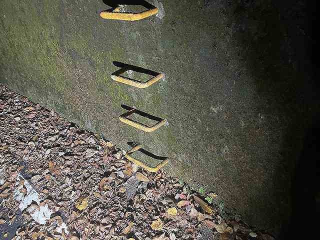
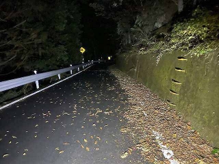
This is the location I wrote about in the previous article, where
there's a staple-shaped yellow ladder on the right slope.
By time, you should be around 2/3 of the way here.
There's another identical ladder a bit further ahead,
but the intermediate lap is taken at the one before this.
Just before this ladder, the gradient becomes noticeably less steep,
and there's a visible seam in the asphalt color,
and that's where the lap was taken when passing through,
but the asphalt seam that was used as a marker
has disappeared due to repairs.
Since starting from the sawmill is no longer done anyway,
it might not be useful as a timing reference.
But knowing that the gradient becomes easier after this ladder is useful information.

About the blind left corner on the descent in
the diagram from the previous article:
↑These are all different locations, but
they have in common a sharp left corner
after a straightaway.

Higher up there were lots of fallen leaves.
If they're wet, they can be surprisingly slippery, so be careful.

These look like the same image repeated,
but actually they're all different bridges.
Concrete paving on the bridge with right corners alternates
with the left corners I mentioned earlier, continuing over and over.
Since I turned back around where the yellow ladder is when light rain started,
the images are only from below that point, but
there are similar features above as well.
Before the repairs, there were tricky steps at the boundaries
between these bridge surfaces and the surrounding pavement,
but they've been neatly filled in on almost all bridges.

This concrete section fairly far down is
the only bridge with an angled cut like a slice of hanpen (fish cake),
and it has a somewhat larger seam, so be careful.
Next, about the deer seeker element in this article.
I used the action camera because the last time I climbed Nabeyatoge Pass,
I encountered a raccoon.
Not a tanuki (racoon dog). The tail had complete stripes.
Two of them were on the right side of the road when I suddenly appeared,
they got scared, zipped across in front of me, and escaped into the grass on the left,
and I spotted another individual separately.
I wanted to film that, so I mounted the action camera
on the handlebar, but I didn't encounter any raccoons.
However...
I encountered a Mountain hare on the descent!

Super quick!
↑This guy

↑This frame looks most rabbit-like.

After this, it ducked under the guardrail on the right
and escaped into the forest...
On the same Izumi mountain range as Nabeyatoge,
there's a pass called Inunaki-yama (dog-bark mountain).
The hot spring there is read as Inunaki "yama".
There's also a hot spring called Jimpu (Jimpu-onsen) along the road,
so it's sometimes called Jimpu Pass.
The tunnel at the summit is also called Inunaki Tunnel,
but its official name is Ikeda Tunnel.
Previously, on a climb there, I saw quite a large raccoon,
two of them in the center line of the road,
and on the descent I saw a mountain hare on the left white line,
so later I went twice with an action camera mounted,
but both times came up empty.
However, I did go to the summit tunnel and take photos.

↑Ikeda Tunnel, Wakayama side

↑Ikeda Tunnel, Osaka side
It has a spooky vibe.
These weren't taken on the same day—
the second one is 5 days after the first.
Also, though I wrote Osaka side on the second one,
the truth is this tunnel is not at the prefectural border;
the border is about 2 km before the tunnel,
and even the Jimpu hot spring beyond that
is located in Kino-kawa, Wakayama Prefecture.
The descent on the Osaka side there is useful for checking
whether my homemade chain guide (→here) is working
(whether chain drop is occurring), so
that was originally my motivation for the climb,
and seeing the raccoon and hare motivated my two subsequent visits.
This was in August, when during the COVID situation
there was stronger social pressure against traveling to other prefectures,
so I didn't descend to the Wakayama side.

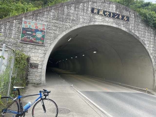
This is another matter, also on the Izumi mountain range, the
newer tunnel of the newly switched road at Kazahaki Pass.
This was in June, the time was around 6:40 AM,
but at this time of year now, sunrise is around then so it wouldn't be this bright.
Before this tunnel there were (at least back then)
multiple signs like "Please avoid non-essential outings!"
and the pressure to not come to Wakayama for no good reason was so strong
that even though I didn't have a real purpose, I turned right around
and went back the way I came.
Actually, the prefectural border here is just a bit before the rest area,
so technically I did cross into Wakayama Prefecture.
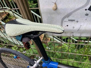
At this time I had a Fizik Adaptive saddle mounted,
and I'll write an article about that eventually.

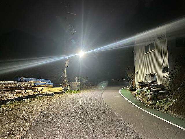
↑In front of the rest area toilet I just mentioned
The time I came before, there was
a swallow nest with chicks in the building housing the toilet,
but since it was near the entrance of the women's restroom,
I was afraid of being misunderstood, so I didn't take a photo.
↑Snail Sensei
When I dripped some water from my bottle on it, it seemed to perk right up.